Mayan World
Mayan Ruins in Yucatan
Established in the southeast of Mexico, the Mayans occupied what are today the states of Yucatan, Campeche, Quintana Roo, Chiapas and Tabasco.
In the Yucatan peninsula you can visit the most important archaeological sites without having to travel great distances, we invite you to see the new light and sound show in Chichén Itza or be surprised by the beauty of Uxmal, observe very well each one of the stones that are in the areas since many of them have carved the history of the Mayans, a living culture, we recommend visiting the nearby towns to meet the Mayans of today.
Explore The Mayan World of Yucatan
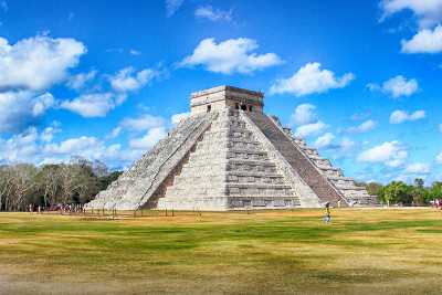
Chichen Itzá Mayan Ruins
The Archaeological Zone of Chichen Itza is in a few words impressive, its main building is the Temple of Kukulkan, recognized as one of the 7 wonders, without forgetting the ancient "El Caracol". mayan observatory
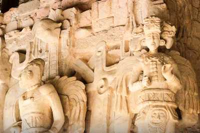
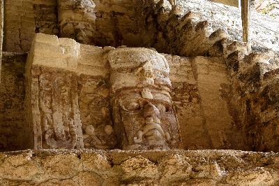
Ek Balam Mayan Ruins
Located in the east of the state, near Valladolid, it is considered an important Mayan city, it has several buildings such as the Acropolis, which contains the Ukit Kan Le'l Tok' tomb with a plaster frieze preserved in perfect condition...
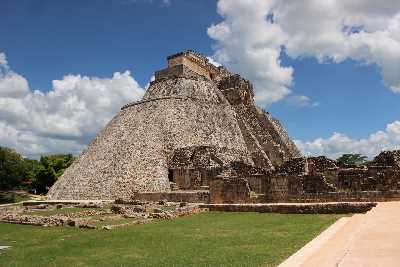
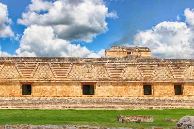
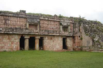
Uxmal Mayan Ruins
One of the most beautiful ancient Mayan cities in the Mayan world due to its exquisite architecture and decoration, its main structure is the Temple of the Magician, accompanied by the Quadrangle of the Nuns, the Governor's Palace...
Ruta Puuc
The Puuc Route is known as a set of ancient Mayan cities located in the Santa Elenan valley, it is made up of Uxmal, Kabah, Labná, Xlapak, Sayil, Oxkintok, the Loltún caves and the Calcethok caves
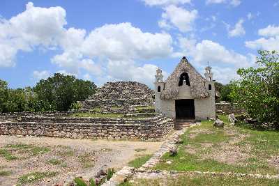
Xcambo Mayan Ruins
Xcambó is located on the Yucatecan coast, in the municipality of Dzemul. It is considered one of the largest areas on the peninsular coast and with large buildings.
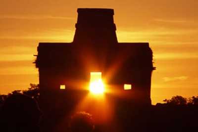
Dzibilchaltun Mayan Ruins
Dzibilchaltún the Mayan city whose name means "The place where there is writing on the stones" its main building is the Temple of the 7 Dolls, it has a Museum and an open cenote called "Xlacah"
Chacmultun Mayan Ruins
Means "heaps made of red stone", in the Mayan language it applies specifically to the group of buildings in the northwestern part of the site. His name has been expanded to include the entire ruin. The ruins were discovered...
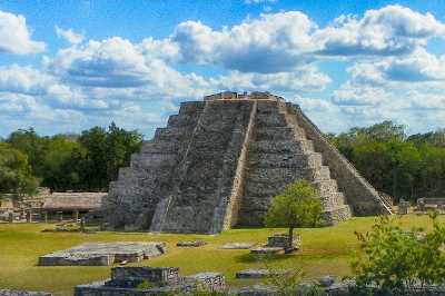
Mayapan Mayan Ruins
It was a Mayan city of the postclassic period, it is located in the south of the state of Yucatan. Its population reached an amount of 12,000 inhabitants, Mayapán was founded by a group of cocom whom experts associate with the Mayan - Toltec culture.
Quintana Roo Mayan Ruins
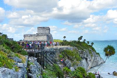
Tulum Mayan Ruins
Tulum is located on a cliff facing the Caribbean Sea, and the city is walled in it you can see several public, civic and religious buildings, within the city lived priests, astronomers, mathematicians...
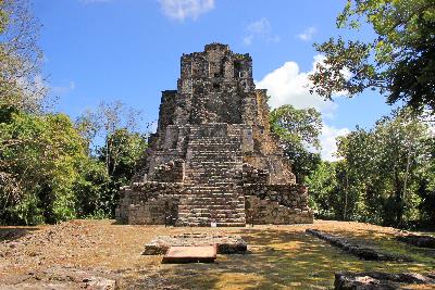
Muyil Mayan Ruins
It is made up of three restored buildings and a road that crosses the jungle to take you to the beautiful lagoon, forming a total of 500 meters of distance, it is said that this is where the commercial route began, it was here where the Mayans interacted
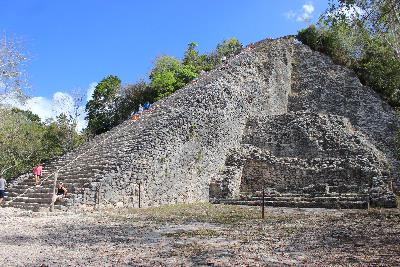
Coba Mayan Ruins
It is located about 40 km northwest of Tulum and during its heyday it is believed that it had a population of 50 thousand inhabitants, its main building is the Mayan pyramid known as Nohoch Mul, it has a Mayan astronomical observatory...
Kohunlich Mayan Ruins
It is the most extensively studied site in Quintana Roo, it also has the largest number of areas open to view. This site is of great interest for its architectural complexes explored to this day allows...
Campeche Mayan Ruins
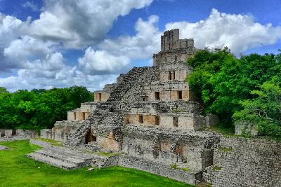
Edzna Mayan Ruins
Edzná had numerous religious, administrative and residential buildings distributed over an area of approximately 25 square kilometers. Its architecture is influenced by the Puuc, Peten and Chenes styles.
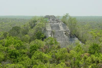
Calakmul Mayan Ruins
In Calakmul there is one of the largest samples of the history of the Mayan culture, because in a vast expanse of jungle diverse archaeological zones are concentrated, but that is not only the attraction because they are also immersed in....
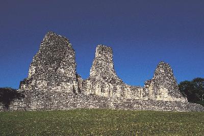
Xpujil Mayan Ruins
The structure that stands out the most is building I, which has the peculiarity of being the only one built in a Río Beec style with three towers, thus being the most representative of this place. Studies have revealed that this community arose...
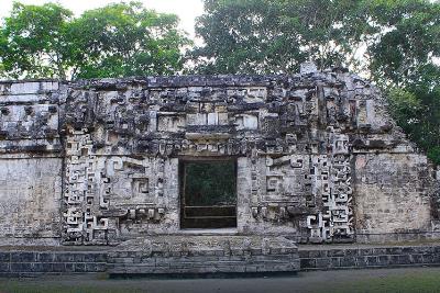
Chicanna Mayan Ruins
Its name means "the house of the mouth of the serpent", this archaeological site was an important city in the Bec River region, dependent on Becán. Its development was from the year 300 B.C. reaching its peak between 550 and 700 AD